
Simple Land ACCESS
Manage Your Land from Above.
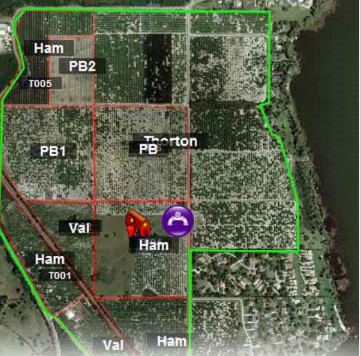
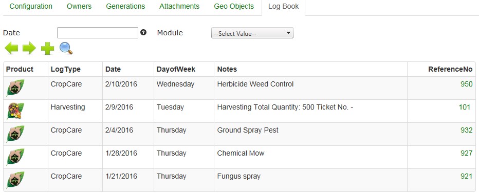
LandMagic GeoMaps allows you to view your entire farming domain from above. Utilizing Mapbox, leading imagery provider, you get a bird’s eye view of your entire operation with multiple base layers like satellite, streets, etc. In addition, users can view an electronic log book of all job activities occuring on the property. A color-coded map depicts Work Order activity, land details, and structures including barns, wells and irrigation points, etc. everything you need to stay in control and manage your land.
The GeoSpatial Viewer allows you to see your land and operations from a birds eye perspective. Have access to all your important farming data right from the map.
Access all your land records and data directly from the map. With a couple of clicks from the map, drill down to an electronic log book of job activities and transactions
that took place on a specific land/block area or create a work order.
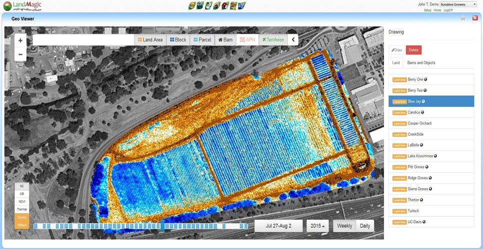
GeoMaps allows you to create and add your own custom imagery and maps to visualize your data in a whole new way. Now you can optionally subscribe to TerrAvion's Overview imagery service.
This low cost service provides hi resolution, high frequency imagery flown over your land parcels and delivered overnight, allowing you to compare imagery to effectively identify issues and create corrective actions. It's actionable aeiral imagery for agriculture and a way to better target your time to manage pests, iffigation, crop growth, harvesting, etc. The Top 7 Use Cases for Aerial Imaging in Agriculture today.
Sync with Mobile Magic
Upload points collected during scouting observations from MobileMagic to GeoMaps for easy viewing on your mapped land. Device flexibility offers a variety of GPS tools for fencing, triangulation, striping, and collecting points.
Benefits of GeoMaps:
- Replace map books with quality images of your land
- Upload shape files from your existing GIS system and/or draw your own shape files
- See job activities, harvesting tickets, and more, all in one location
- Optionally subscribe to low cost Hi Res, Hi Frequency imagery
- Flexible for third-party data import of imagery shape files
- See your Master Data come to life right on the map!
Takes less than 60 seconds.